
Exploring Donegal and Sliabh Liag
There are regions of Ireland that somehow manage to feel relatively untouched by the rest of the world. Donegal is one of these places. I had lived in Ireland an entire year but had never ventured to Donegal, under the pretense that I really didn’t know what it had to offer. In a last-ditch effort to explore what I hadn’t already before moving home, I spontaneously booked a roundtrip bus ticket to Donegal town, one night at the local hostel, and a day trip with Donegal Tours. I was surprised with how remote the beautiful and rugged landscape felt. At times, it was like sitting on the edge of the world. Although standing atop the some of the highest cliffs in Europe overlooking the Atlantic, I suppose I was.
County Donegal is located in the northwest of Ireland, in the Ulster province. The Wild Atlantic Way, beginning way down in County Cork, snakes its way up the coast to Malin Head. Along the way, it passes some of the highlights of Ireland – like the dramatic Slieve League (Sliabh Liag) cliffs, Fanad Head lighthouse, and more. While visitors flock to sights like the Cliffs of Moher and Ring of Kerry, you’ll find the views that Donegal has to offer are just as impressive, and far less crowded. Donegal is also a Gaeltacht region, meaning that the Irish heritage and tradition is well preserved here. This county deserves a spot on any Irish itinerary.
Donegal Town
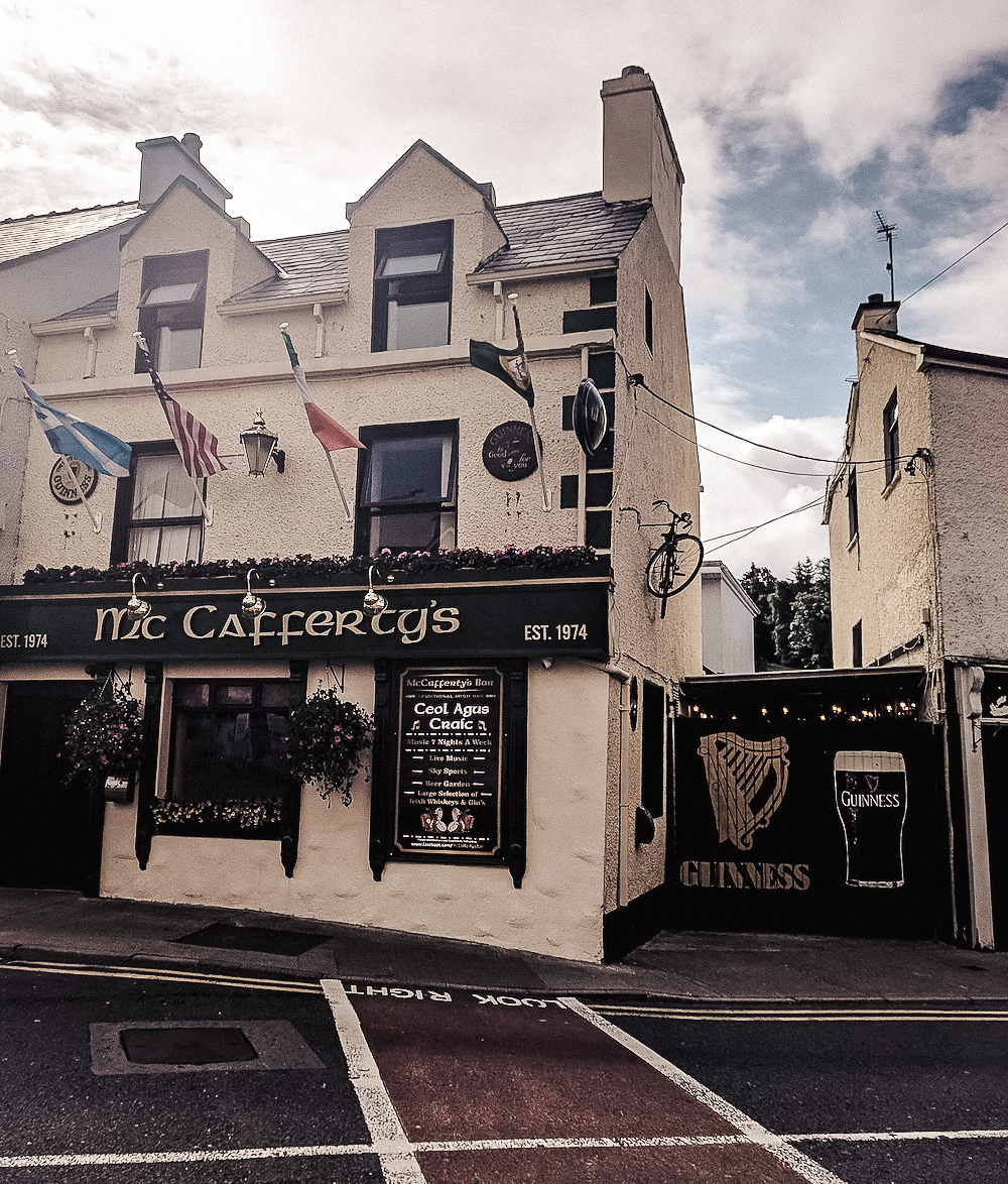
There are a few cities in the county that make great bases for exploring, namely Donegal town and Letterkenny. I opted to stay in Donegal, and found the town pleasantly quaint. A handful of cafes and shops line a public square known as the Diamond. The River Eske runs through the town into Donegal Bay. Pubs like the Reel Inn and McCaffertys offer live music and good craic nightly. To one end of the Diamond, O’Donnells Castle is open to visitors. It was built in the 15th century, although 17th century additions have been added. All in all, its an affable town that feels nothing like most of the other cities in Ireland, but altogether Irish.

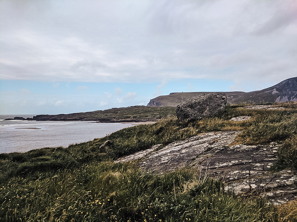
Muckross Head
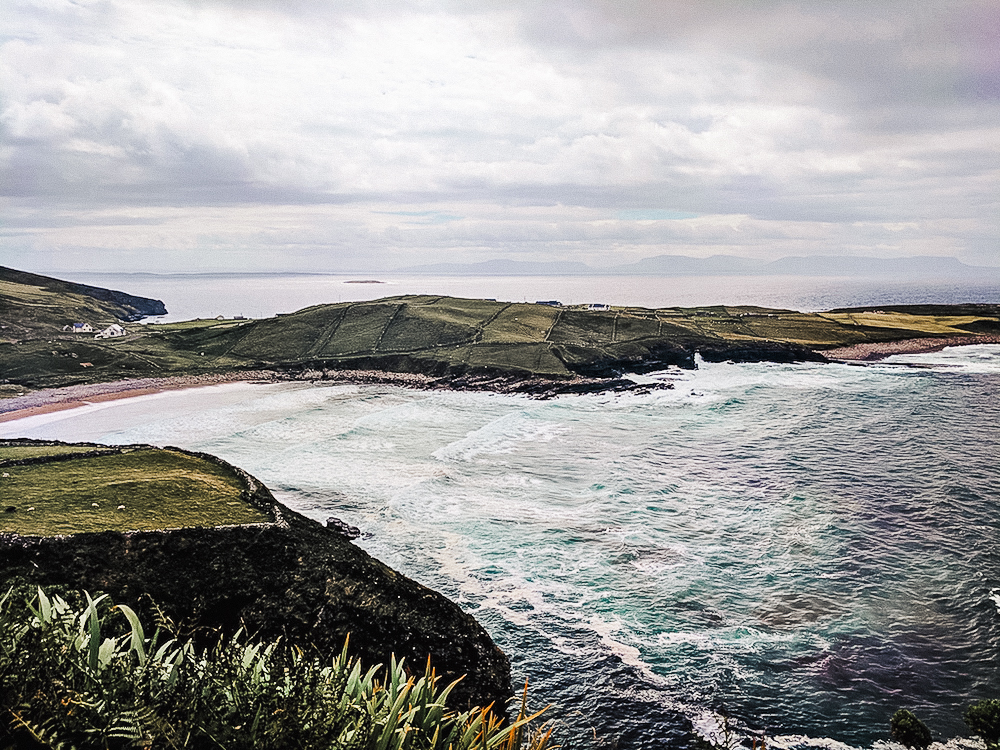
Heading out of Donegal town to explore the rest of the county, our tour passed through Killybegs, a village known for their fishing industry. You’ll find the port brimming with vessels like iron giants. The road continues on to a small peninsula nearly 10 km to the west – Muckross Head. The area is popular for climbing and surfing. And on a clear day, looking across the water, one can even see all the way to the flat peak of Benbulben in County Sligo.
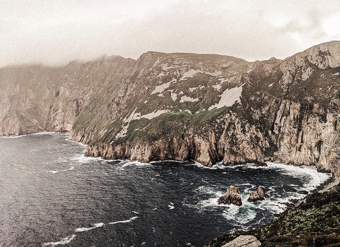
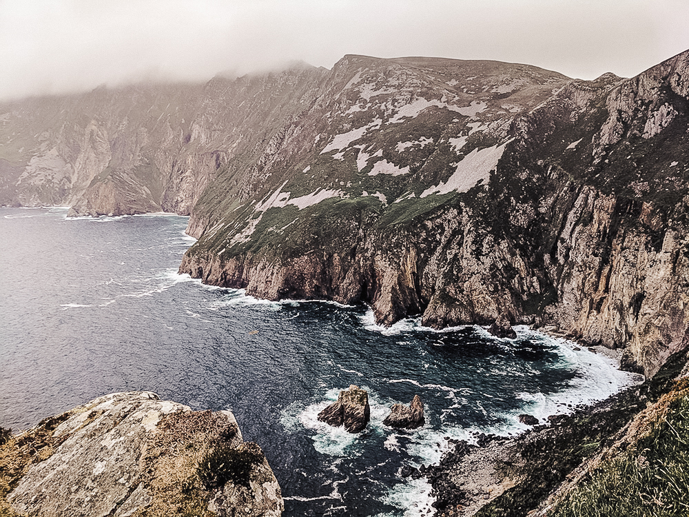
Sliabh Liag
Unpopular opinion: Sliabh Liag over the Cliffs of Moher any day. The cliffs of Slieve League are Ireland’s best kept secret. They are actually the highest accessible sea cliffs in Europe, standing 1,972 feet (601 meters) above sea level at their highest point! This makes them nearly three times taller than Cliffs of Moher, and though they differ quite a bit, they are just as dramatic. While Moher is a straight drop, the cliffs at Slieve League gradually slope into the Atlantic. The views are just as stunning… and harrowing. Not to mention that the crowds at Slieve League are practically non-existent. It’s peaceful. There isn’t a gift shop. It’s just you and Mother Nature.
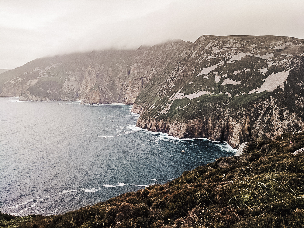
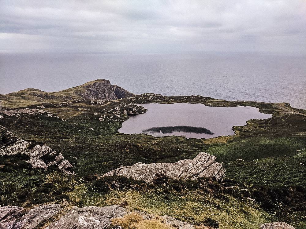
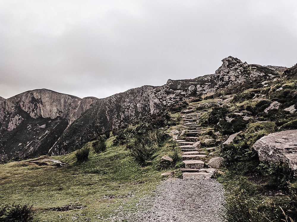
Slieve League is also a dream for hiking. Stone trails lead up to the peak of the hill, and various trails stretch across the cliffs. Dare to trek the One Man’s Path, aptly named because of how narrow the trail can get at the top. Or if you aren’t one for heights, take a boat tour from Teelin Pier. You can even try your hand at angling while you’re at it! The region is a spectacle of flora and fauna.
Glen Head Martello Tower
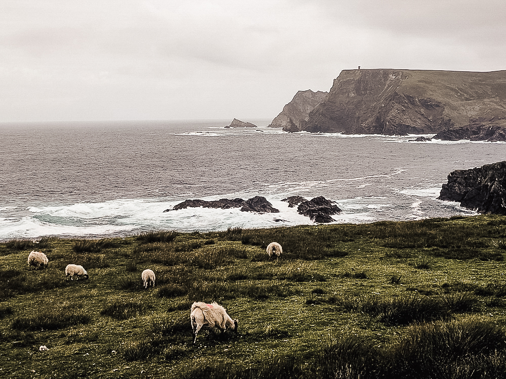
The best part about driving the Wild Atlantic Way is that there is no shortage of vantage points to pull-off and admire the view. Heading north from Slieve League, the road approaches a region known as Glencolmcille. In the distance, a large cliff face protrudes into the Atlantic, and atop is a small tower fort. It’s actually a Martello tower, one of many defensive forts that were built across the British Empire during the 19th century. There is a turn-out halfway into town that offers a dramatic view of the coastline. Sheep wildly roam the countryside and a strong wind blows in from the sea. It’s views like these that define Ireland’s beauty.
Glencolmcille
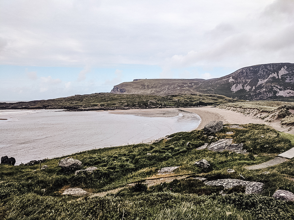
North of Slieve League on the peninsula is a region known as Glencolmcille (or Glencolumbkille). The Irish name Gleann Cholm Cille translates to the Valley of Colm Cille. Saint Columba (Colm Cille) was one of the three patron saints of Ireland and lived in the valley, planting several churches whose ruins can still be seen today. The history of the region dates back to the Stone Age, when farmers first began to settle the land. Standing stones dot the countryside, and Glen Bay Beach stretches off towards Glen Head. The landscape is rural and rugged, where time nearly stands still and tradition is very much alive.
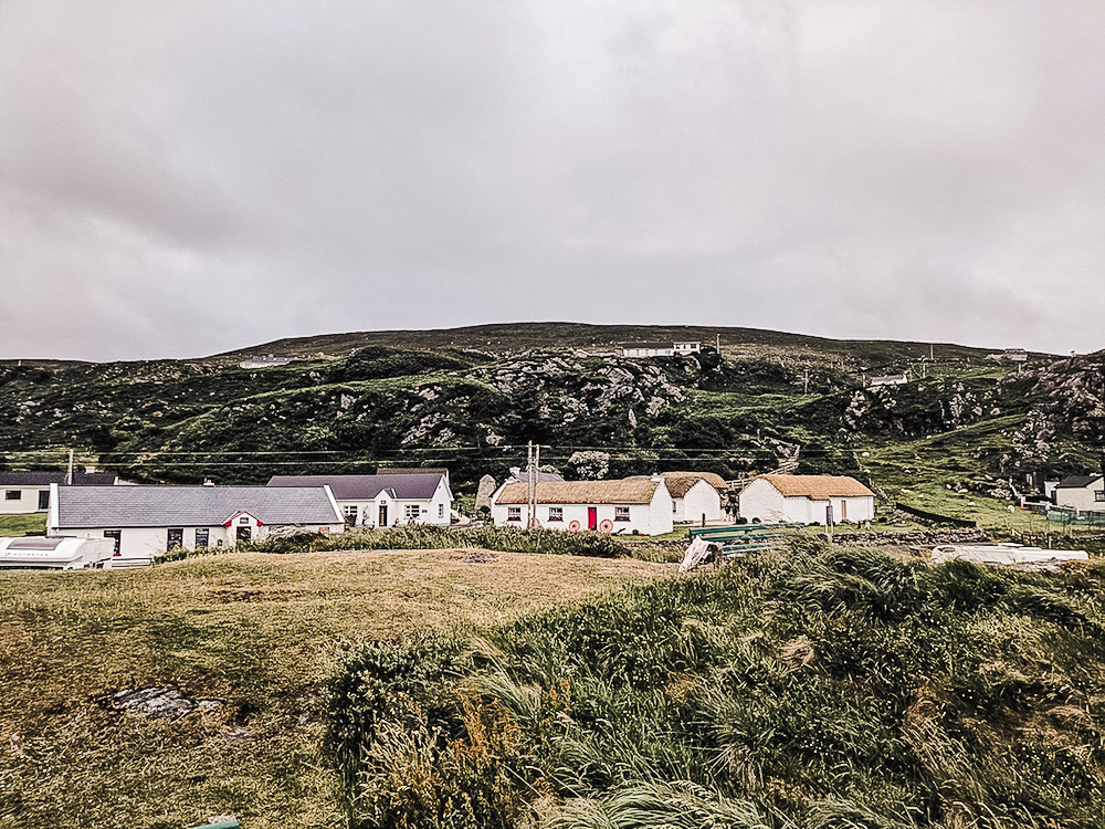
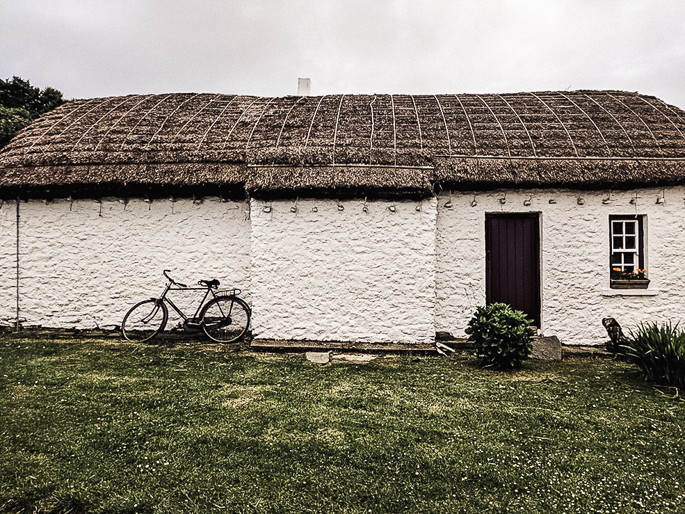
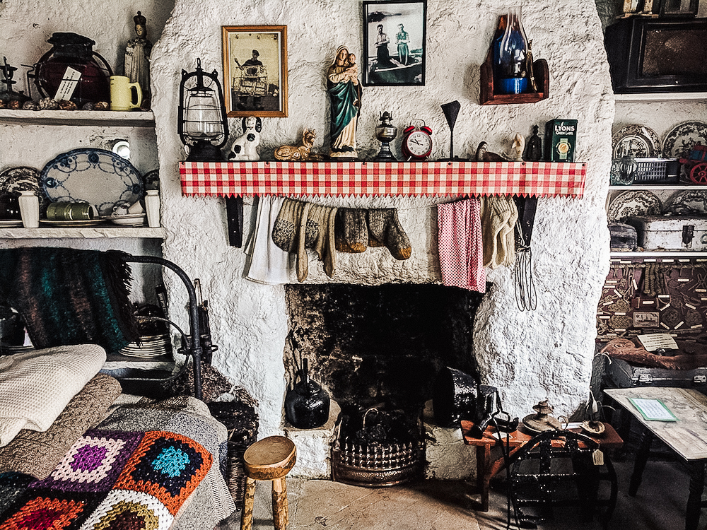
Perhaps on of the most famous attractions in Glencolmcille is the Folk Village. This region was once famous for being the parish of Father James Canon McDyer. McDyer became a spokesperson for the rights of rural people. He was assigned to the district in 1951, and at the time the locals still didn’t have modern amenities like electricity. The reverend developed local industries to help sustain the region, and the Folk Village preserves what rural Irish life had been like. Wander through thatched cottages that housed the schoolroom, pub and grocer, and the villagers themselves. The village describes itself as a ‘living history museum’ that offers a glimpse of what it was like to live in one of the most remote corners of Ireland.
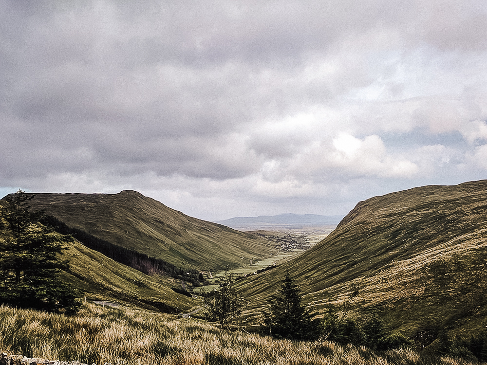
Glengesh Pass
Its nearly 24 km from Glencolumbkille to the village of Ardara, and the road between winds through a spectacular valley pass. There is a vantage point at the top worth pulling-over for. The Glengesh and Mulmosog mountains rise on either side, and the remote moorland sweeps to the horizon. A vendor sells snacks at the point and our guide highly recommended tasting the seaweed-flavoured popcorn before continuing the drive down into the valley.
End your day in scenic Ardara, once named the best village to live in Ireland. Visit Eddie Doherty’s shop to watch him hand-weave tweed goods, or grab a pint. I struck up a conversation with an elderly Irish couple working in the visitor’s center and they were quite possibly the nicest people I have ever met. They were always excited to have visitors in this corner of the world. I left Ardara with a full heart, and that’s all I could hope for to end the day.
A full day, yet it only exposed the treasures of southwest Donegal. There are plenty more to be discovered, all the way up to Ireland’s northern-most point. I can’t wait to go back to visit Letterkenny, the lighthouse at Fanad Head, Malin Head, and Glenveagh. So if you’re heading to Ireland, consider adding Donegal to the itinerary. It may not be the highlight of all the guidebooks, but its remote beauty makes it worth the visit.
Heading to Ireland? Check out my post on exploring the famous Ring of Kerry!
xx, J