
Hiking Glendalough’s Spinc and Glenealo Valley Trail
At Glendalough, it’s easy to see why wild Wicklow is known as the Garden of Ireland. A network of trails loop past old monastic ruins and through towering forests, up steep ridges like the Spinc and around lakes and valleys. Sitting at the heart of the Wicklow Mountains National Park, Glendalough is a watercolor canvas of emeralds and blues. There are actually nine marked trails throughout Glendalough, varying in length and difficulty.
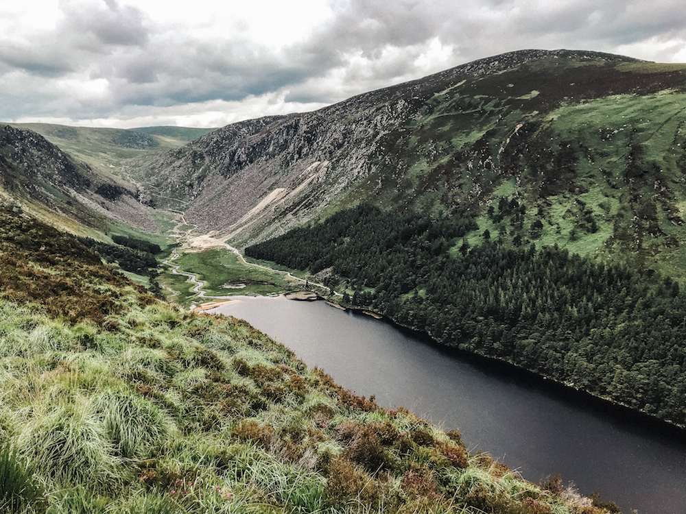
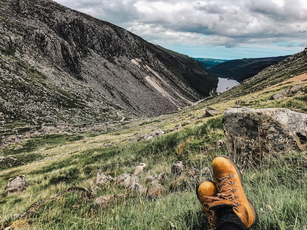
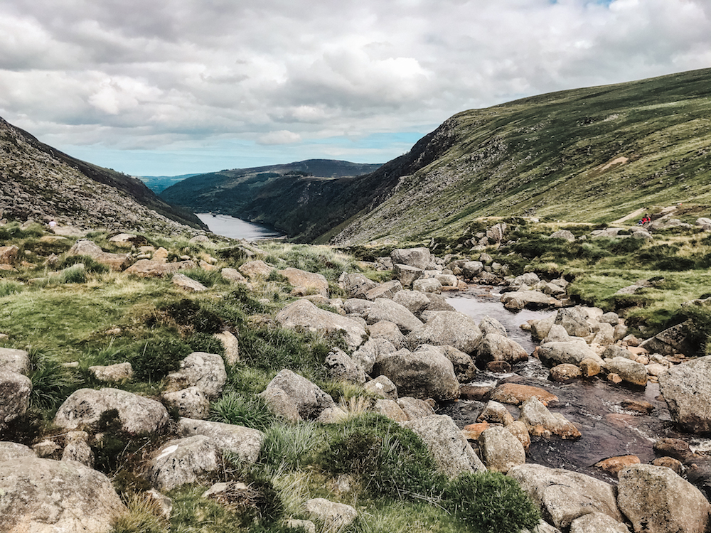
But perhaps the most rewarding is the Spinc and Glenealo Valley white route – a 9 km path that starts at the foot of the Upper Lake, winds its way up past Poulanass Waterfall and along the Spinc Ridge before snaking down through the valley along the Miner’s Road and back alongside the Upper Lake. Adventurous hikers climb a total of 380 meters and are rewarded with breathtaking vistas over the valley, back towards Saint Kevin’s monastic settlement and on to the Wicklow Uplands.
Route: White Trail
Trail length: 9 Km
Estimated time: 3.5 hours
Difficulty: Moderately Strenuous
Starting Point: Glendalough Upper Lake
What to Bring: Suitable footwear; rainwear; lots of water; hiking poles (optional); picnic (recommended).
Getting there
Wicklow’s close proximity to Dublin make it the perfect day trip. The St. Kevin’s service bus departs from Stephen’s Green and drops passengers right at the Glendalough visitor centre a little over an hour later, all for €20 round trip. I left Dublin at 11:30 AM and after a scenic drive arrived in Wicklow by 12:50 PM. During the summer hours, the Saturday bus returns to collect visitors at 17:30 PM, giving hikers nearly four and a half hours to enjoy. Most other days the return service is at 16:30 PM.
The Spinc does take a full three and half hours to complete, as I found to be true, and that was at a fairly brisk pace – the fear of missing the only bus back nagged at the back of my mind throughout the hike. I still completed the trail with forty minutes to spare, but the afternoon felt rushed and like I’d forgone any opportunity along the trail to pause or take my time.
With that in mind – I would say it would be near impossible to make it back comfortably for a 16:30 bus – 17:30 is definitely doable, but if you’re the kind of person who would prefer to take your time on the trail (or stop for a picnic as I plan to next time I head to the Spinc), I recommend either driving yourself or spending the evening. Be sure to arrive early to secure a parking spot as it does get busy when the weather gets nice.
Public Transportation: St. Kevin’s Bus Service
Parking: Glendalough Upper Lake Car Park (alternatively start at Glendalough Visitor Centre)
Nearby Accommodation: Check out the Glendalough Hotel or the Glendalough International Youth Hostel.
On the Trail
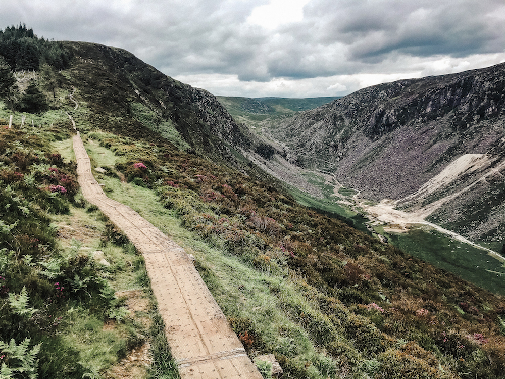
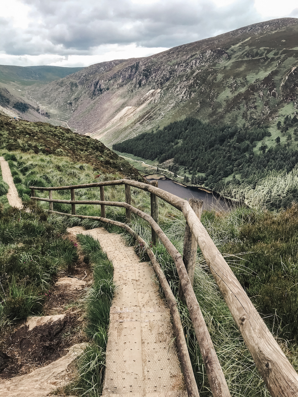
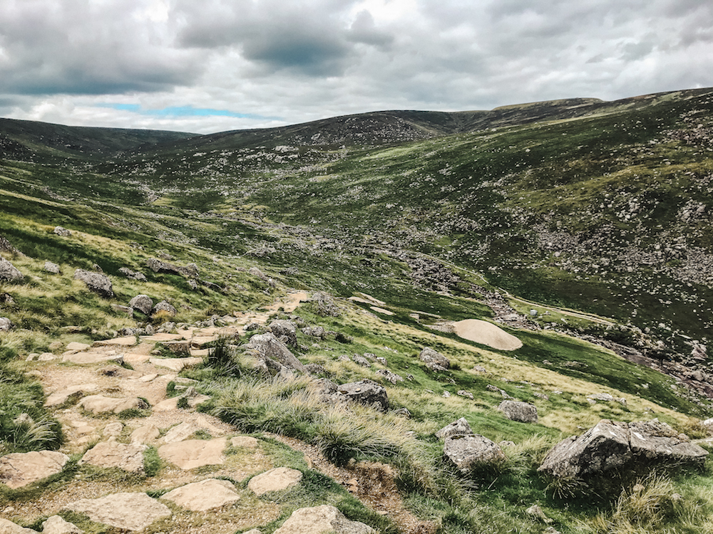
The trail loops through different habitats, from native broadleaved woodland to blanket bog. The terrain varies – the climb begins on gravel paths through the forest before turning to boardwalk along the ridge, and eventually descends into the valley on rocky trails. As you hike along, you might even spot deer or the wild goats that live in the valley.
Though people seemed to be hiking both directions, boards advise that the path should be one directional. Start from Poulanass Waterfall and continue clockwise towards the Miner’s Road, not the other way around. I recommend starting at the visitor centre – this extra bit of trail will lead you past the Lower Lake as well as St. Kevin’s monastic site. You’ll find the trailhead once you reach the Upper Lake, and white arrows mark the way from there.
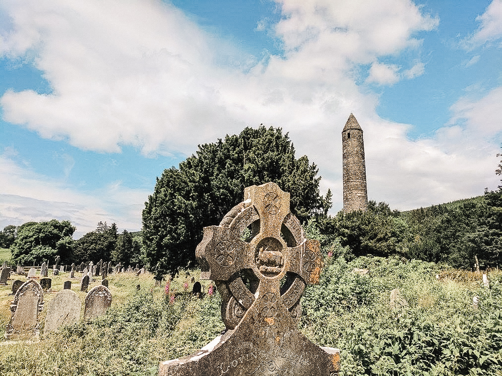
Saint Kevin’s Monastic Settlement
Just past the visitor centre you’ll find the ruins of an old monastic settlement founded by Saint Kevin in the 6th century. Also known as the City of the Seven Churches, this site thrived until locals deserted it following the arrival of the Normans in the 13th century. There are a number of monastic remains, such as St. Mary’s Church, the Priest’s House, St. Kevin’s Kitchen, the Hermitage.
At the heart of it, the Round Tower rises above the settlement, standing at 33 meters tall. Built by the monks of St. Kevin’s monastery, the tower most likely served as a bell tower (cloigtheach), but villagers also used it for refuge during attacks. The main entrance is 2.5 meters above the ground, accessible by a removable ladder in case of threat. The tower is in nearly perfect condition despite being nearly 1,000 years old, and is considered to be one of the best preserved towers in Ireland.
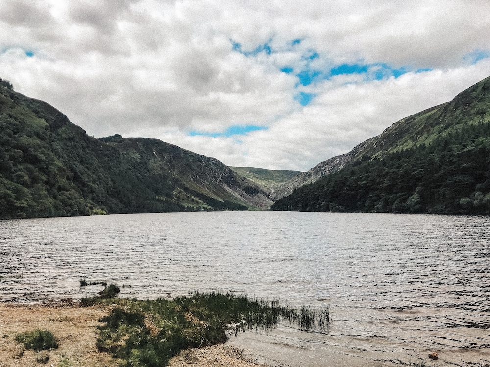
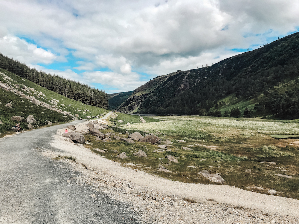
The Lower and Upper Lake
In Irish, Gleann Dá Loch quite literally translates to ‘Valley of the Two Lakes’. Glendalough’s two lakes are referred to as the Lower Lake and the Upper Lake respectively, and were formed during the last ice age thousands of years ago. The walk from the visitor centre and monastic site to the Upper Lake takes about twenty minutes. If you are starting your hike there be sure to account for the extra time (and steps).
The lakes used to be one, but over the years the elements separated them. You’ll pass the peaceful Lower Lake on your right as you walk, eventually reaching the expanse of the Upper Lake. A popular picnic spot on sunny days, there’s usually crowds lingering on the grassy knolls and pebbled beach here.
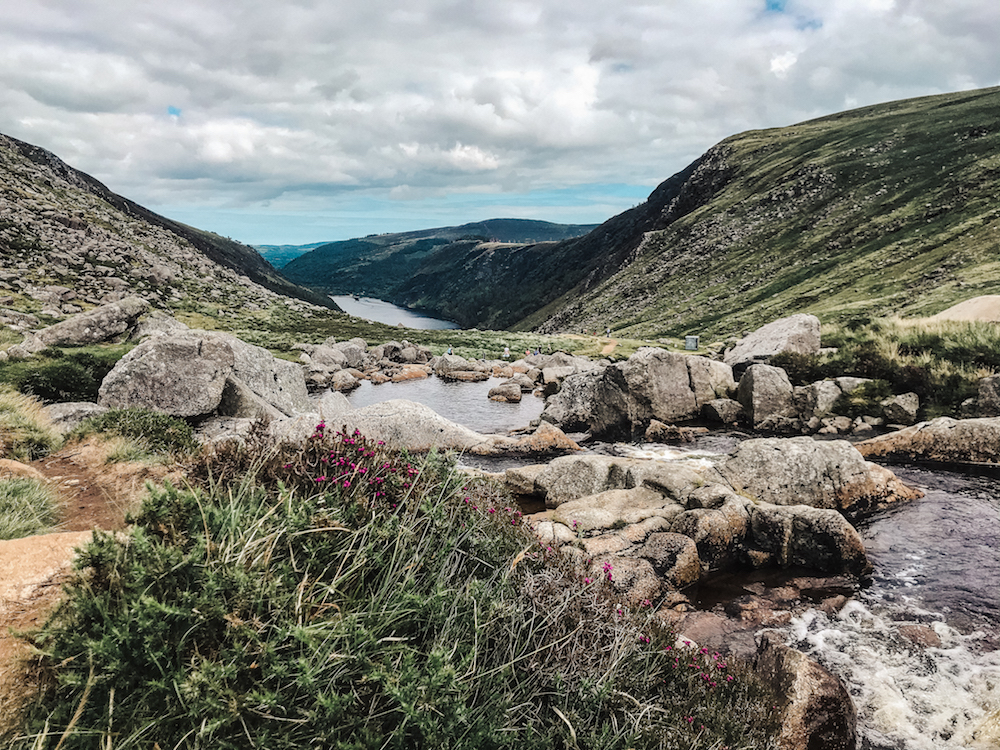
Poulanass Waterfall
To the left of the Upper Lake, the trailhead leads visitors along a steep path that climbs into the woods, winding along a stream. The Poulanass river name runs to the valley from the south, cascading down the hillside at this narrow waterfall tucked away in between the trees. Beyond the falls, follow the white arrows towards a series of switchbacks that push up out of the woods to emerge out onto the Spinc Ridge.
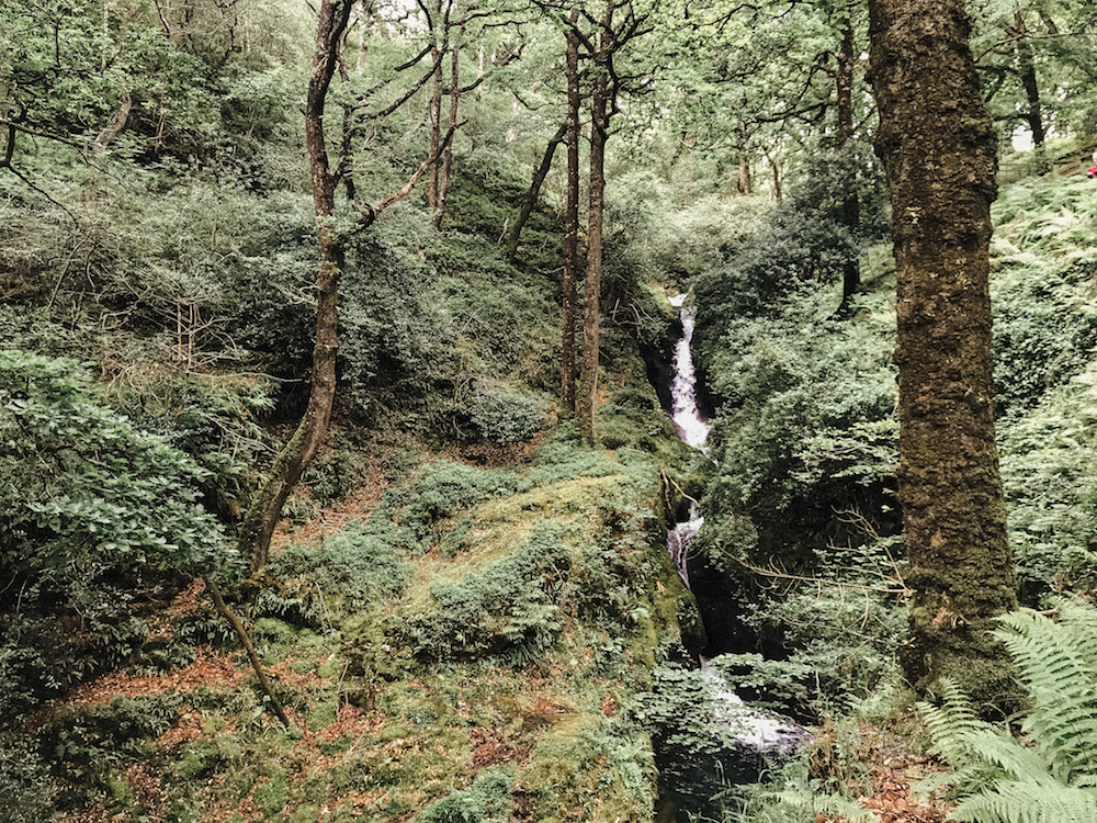
Poulanass Waterfall
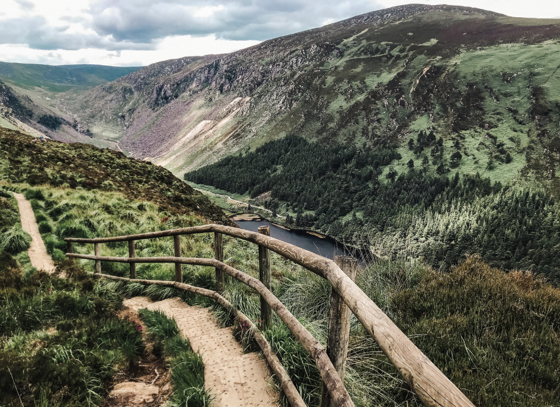
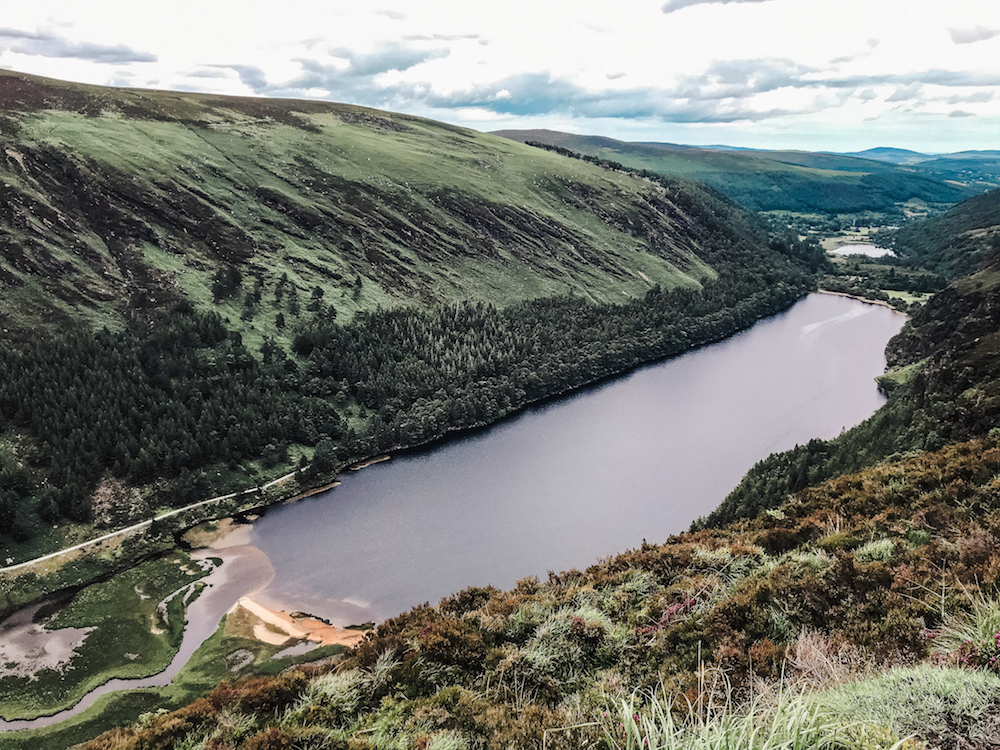
The Spinc Ridge
This stretch of the trail is arguably the most rewarding and scenic. The Spinc ridge lines the southern side of the lake and offers panoramic vistas over the teal waters and lush valley. This section of the trail follows a narrow boardwalk, and at points continues to climb higher. I hadn’t brought my hiking poles but there were several points I wished I had. For those feeling the burn, the shorter Blue Route veers off the trail here back towards the forest.

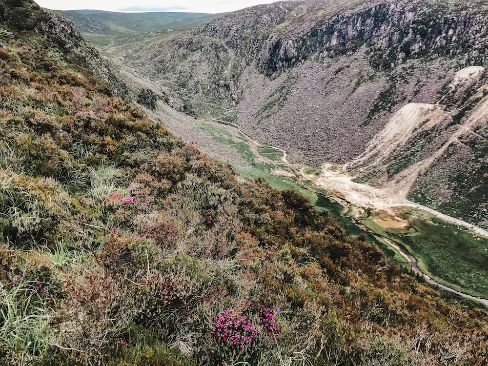
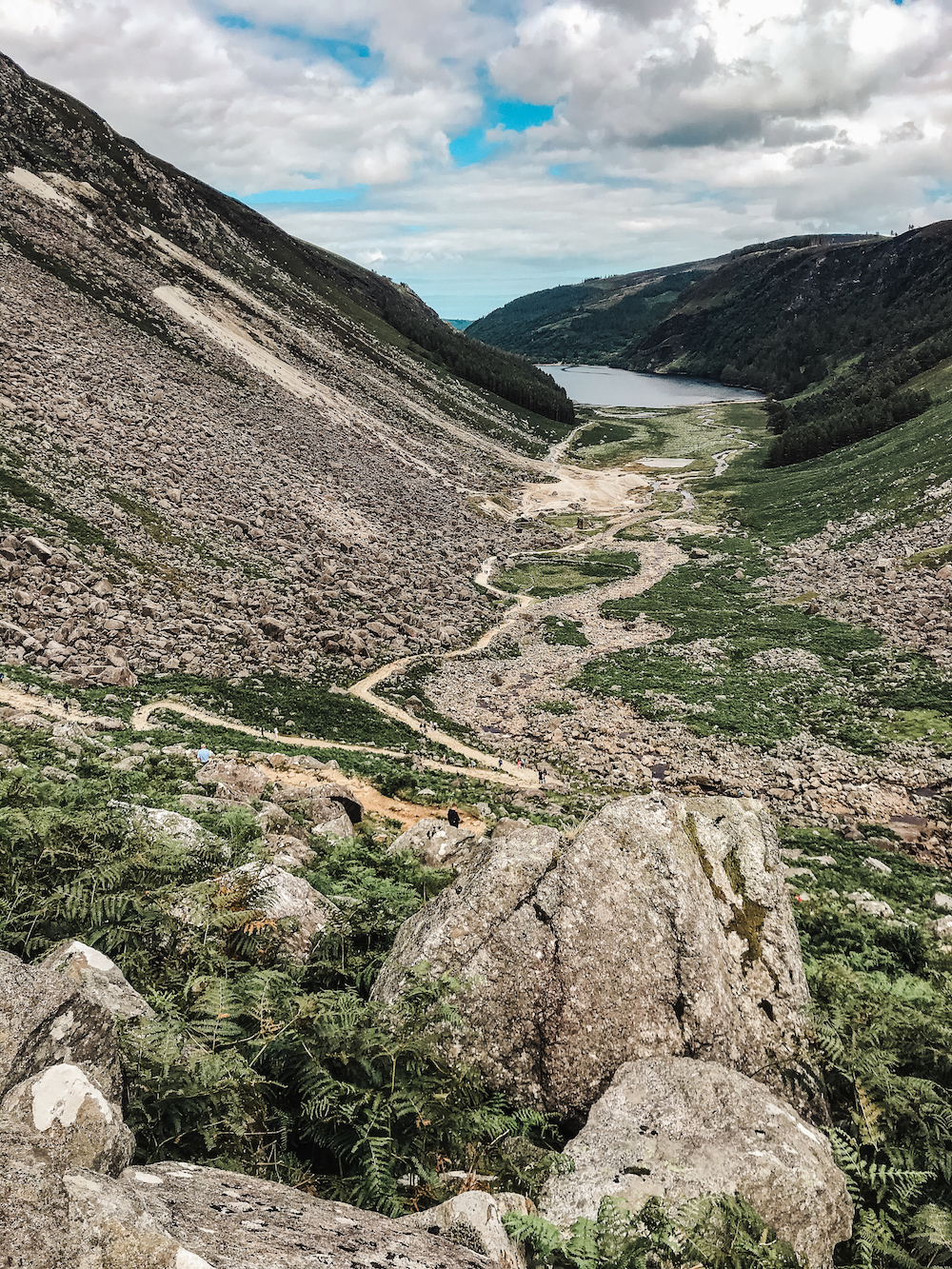
Glenealo Valley
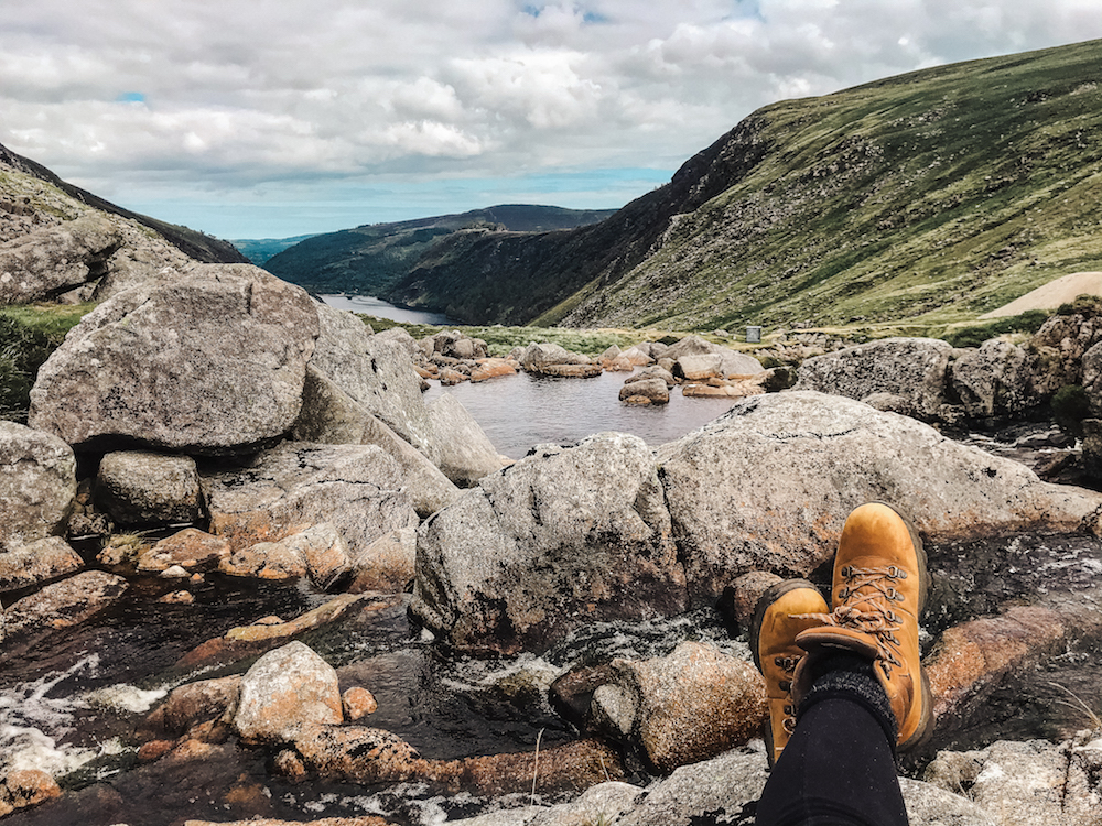
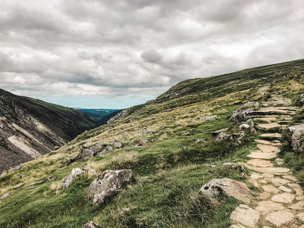
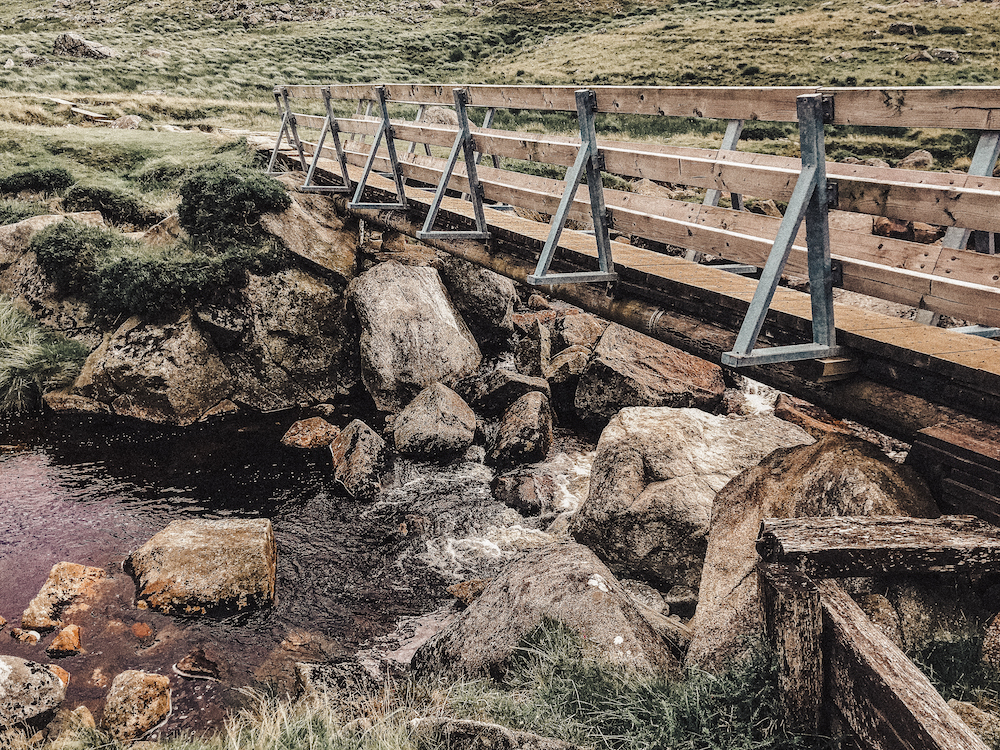
From its peak along the ridge, the trail begins to sweep down into the valley and the boardwalk turns into a stone path. This part of the trail felt otherworldly, a haven reached only by foot. You’ll find plenty of spots to stop and picnic along here. The Glenealo river snakes through the valley on its way to the lake. The trail crosses on a narrow wooden bridge before turning back towards the lake. From here, the footing gets a bit more difficult. Uneven boulders and pebbles pave the way as it descends along a series of switchbacks. I found myself watching where I stepped more than I watched the view along this section. Eventually as the terrain flattens the trail eases, passing into the Miner’s Road.
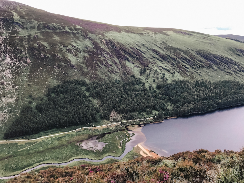
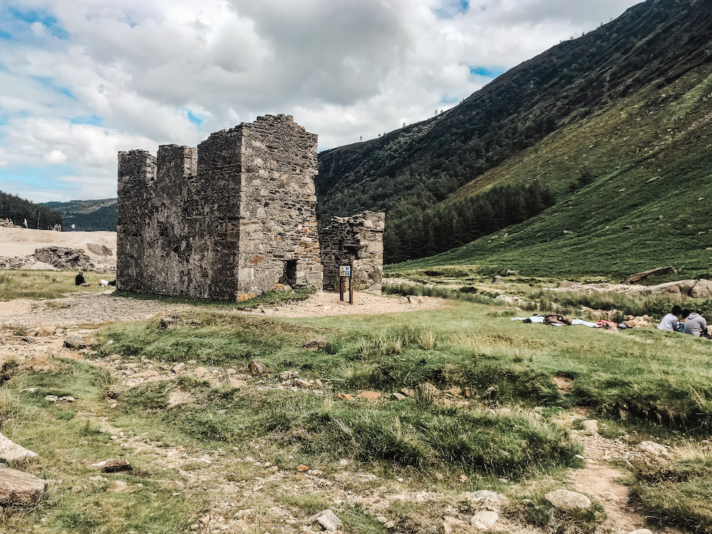
The Miner’s Road
The Wicklow mountains have a rich history of mining. Mining in Glendalough lasted only twenty-five years, commencing in the mid-19th century as Luganure Mines scoured for ore in the region. Mining recommenced for a short period during WWI, but the mines officially closed in 1963. The remains of the mining village remain along the Miner’s Road that loops through the valley towards the home stretch of the trail through Scots Pine woodland alongside the northern side of the lake. Keep an eye out for St. Kevin’s Bed – a cave that can be seen across the lake halfway along the road. Finally the trail emerges back at the Upper Lake, near the car park.
It’s not hard to see why so many say the Spinc is their favourite hiking trail in Ireland – the grass really is greener. Embrace the burn, enjoy the views, and remember to leave no trace.
What’s your favorite trail around Glendalough?
xx, J
Juliane
This is just a great and so informative post, thanks for these tips 🙂
Jacqueline
This is so helpful in planning our trip- thank you!